Minnesota's River of Waterfalls

From the parking lot, I climbed. That's not unusual when stopping along Minnesota Scenic Highway 61 on Lake Superior's North Shore, since woods meet water in a generally dramatic way, either by dropping down to a rocky beach or coming to the edge of a steep palisade that plummets to the water far below. But this was an uphill climb, and away from the lake.
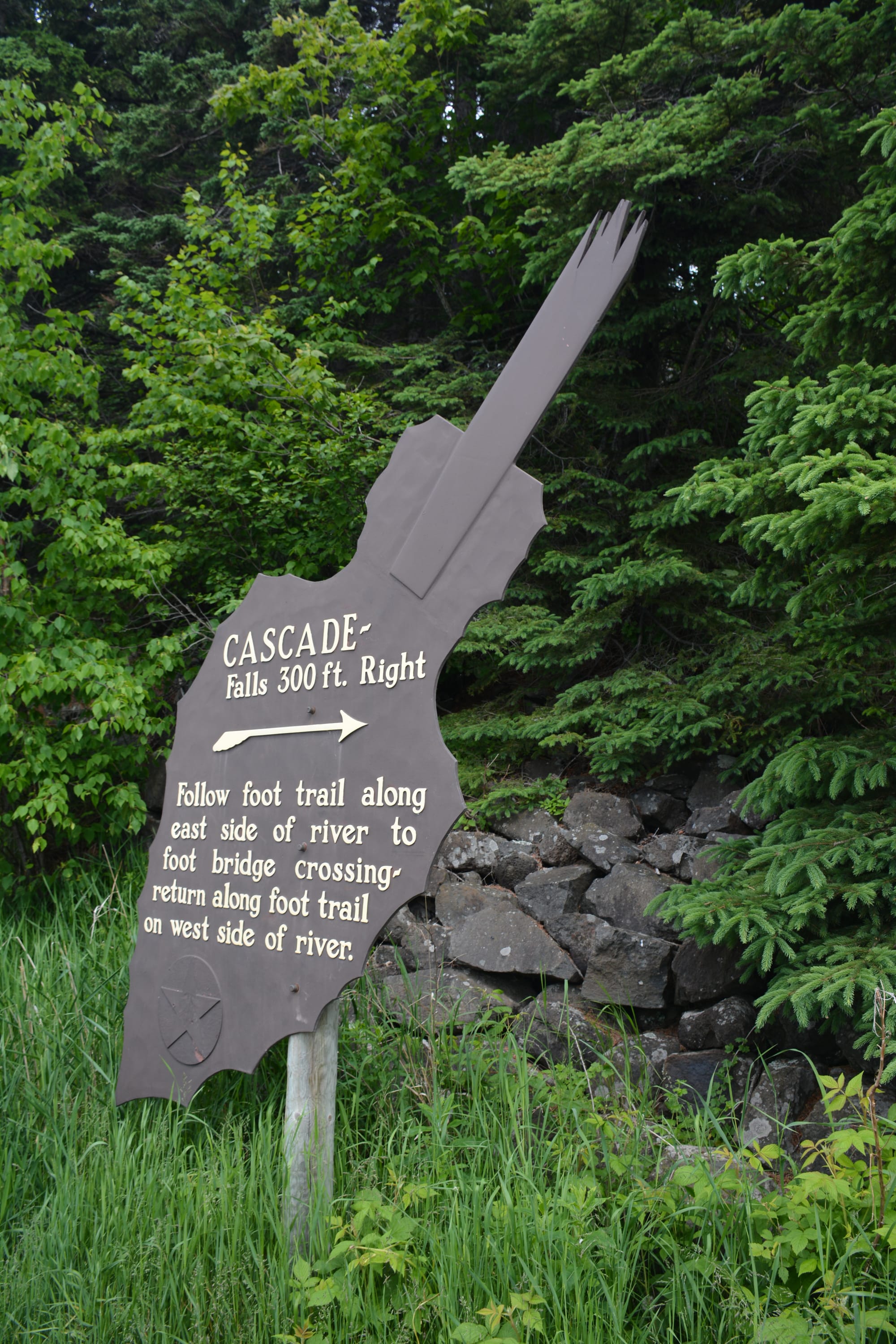
The oddly-shaped sign at the wayside parking area said "Cascade. Falls 300 ft. right" and gave explicit directions to follow a foot trail to a bridge to make a loop.
I'd already picked up a copy of Hiking the North Shore and knew that Cascade River State Park would be an interesting place to take a hike, so it was on my short list of places to explore while I was in Minnesota. It is one of the hillier parks in this part of the state, covering 5,392 acres.
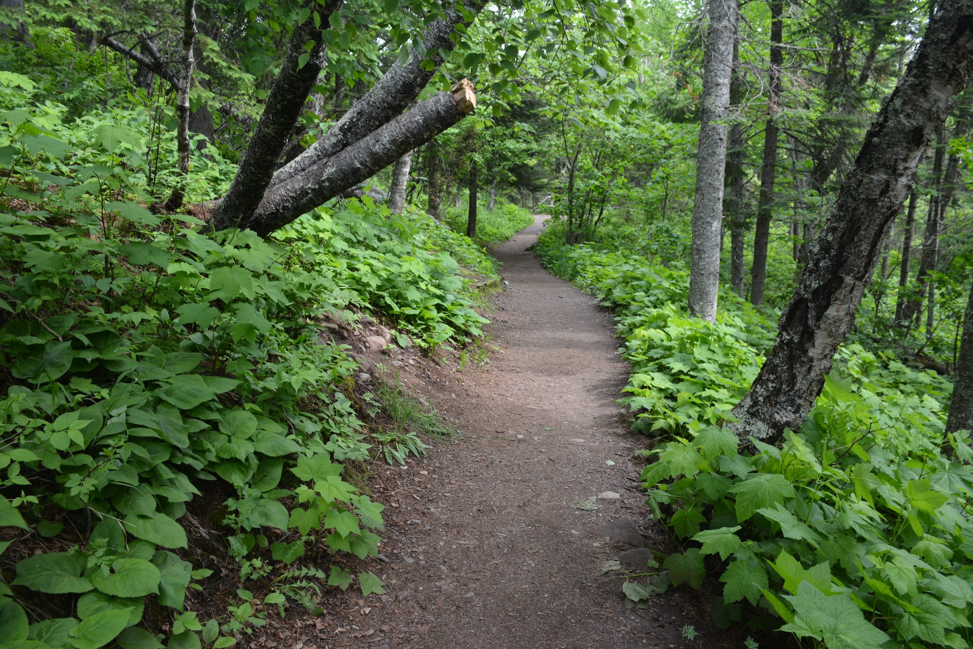
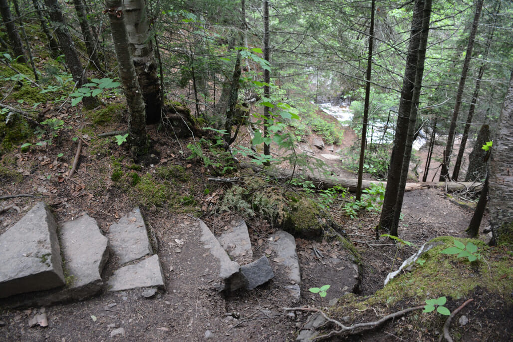
The neatly cut stones and timbers reminded me of Civilian Conservation Corps construction, and indeed, the CCC built these trails. Ancient basalt lava flows are the underlying rock, deep under the soft duff of the coniferous forest floor, and it is through that rock that the Cascade River has steadily eroded its way towards Lake Superior as it drops over 900 feet in three miles.
Sure enough, the footpath immediately went up, up, and up, climbing stone steps until I faced a landing where I could hear the waterfall, and the honking of Canada geese. Having grown up with geese, I know they can be pretty mean, so I did not relish coming face-to-face with them, such that the topography was, as they were sauntering along the level overlook on the trail, seeming to take interest in the view of the falls. Once I reached that level ground, I could at least look down on them and edge around them, all the while being harassed with a chorus of honks. How odd, I thought. Geese at a waterfall.
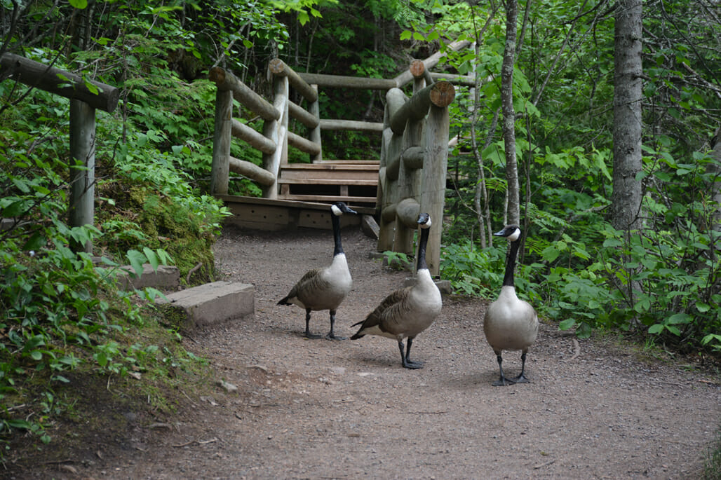
It seemed the trail went to the right - perhaps over that bridge mentioned on the sign, since I couldn't have gone more than 300 feet - and to the left, where it ascended a steep set of wooden stairs. The geese blocked the level path to the right. I chose the stairs. Good idea, as it turned out.
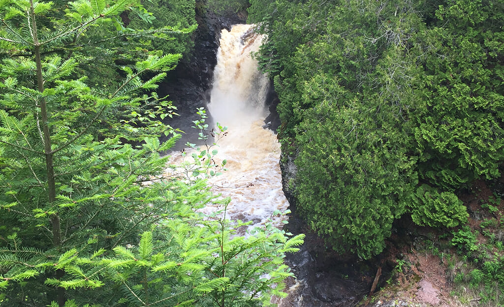
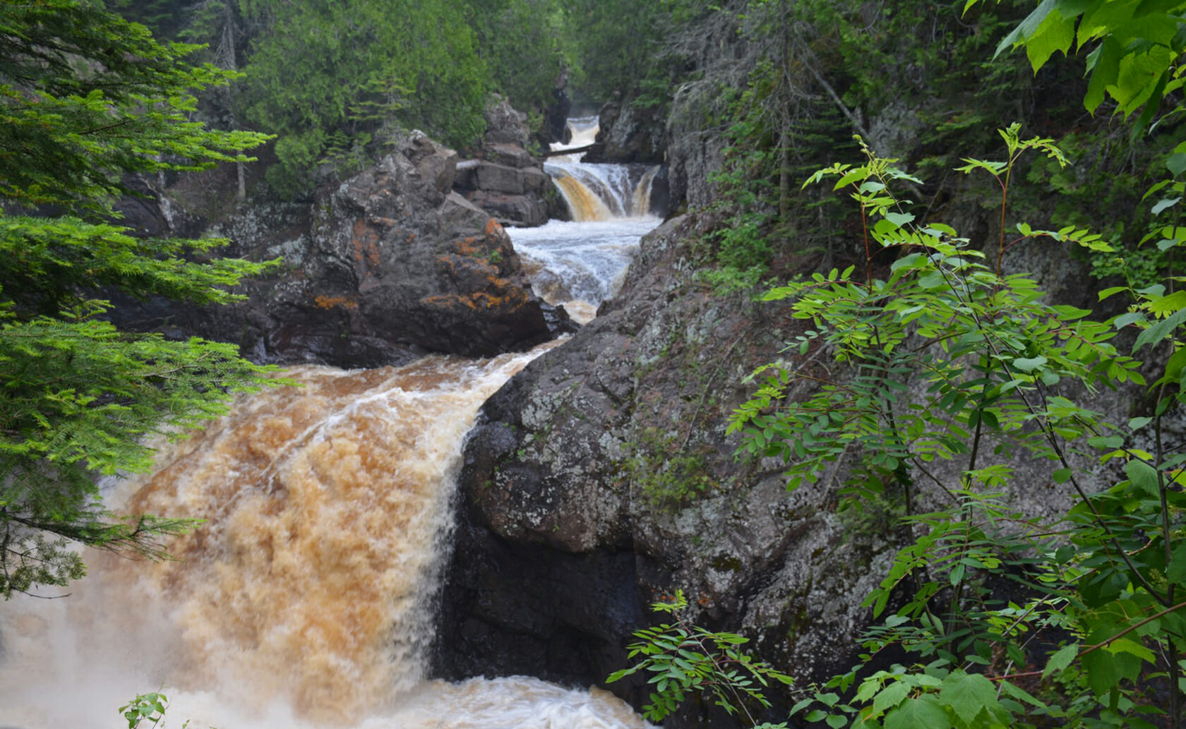
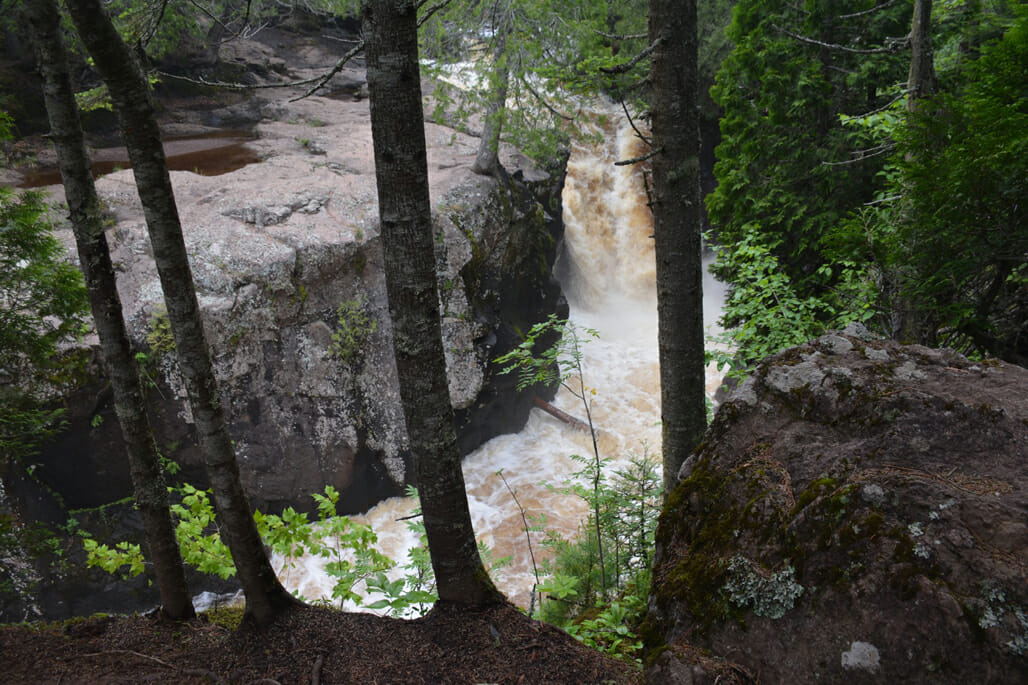
For Cascade River is truly that: a river of waterfalls. The first one, that most wayside visitors stop to see, is just the beginning of a marvelous chain of wild, frothing whitewater rushing through a deep gorge.
As I'd observed in Canada, there was no marring of the wild natural beauty with warning signs and fences or ropes, except for the occasional wooden fence where the slope dropped right off the footpath. It was easy to step off the path and out onto promontories to observe the raging waters. It had rained a few days before, and it seemed the entire Boundary Waters - which lies north of here about 50 miles - was draining through this narrow canyon, such was the enormous flow of water downhill.
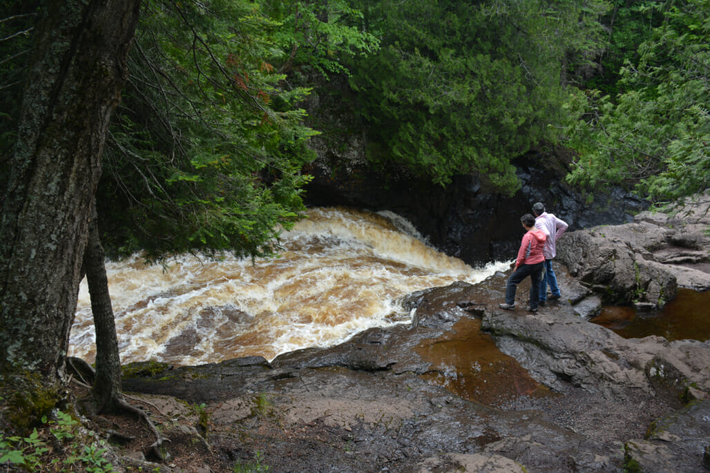
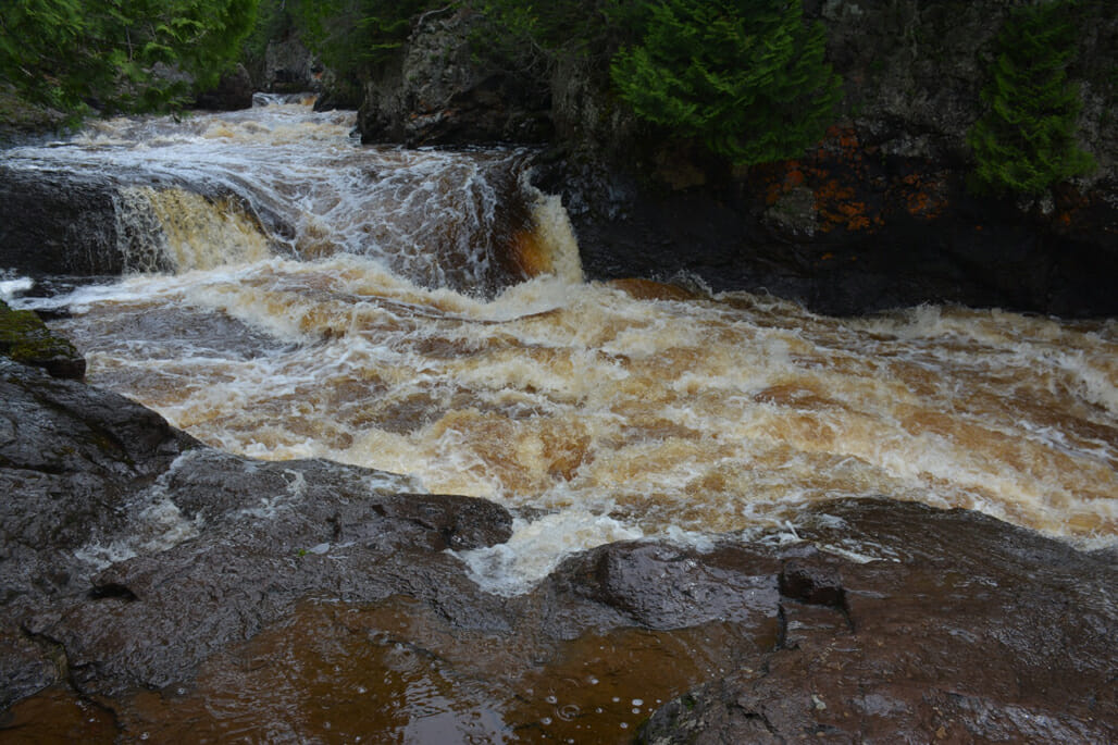
I tend to be nervous with edges, especially along bluffs with wet, slippery rocks. So I was a bit timid crossing the rocky pools off-trail, but I had my trekking poles for balance, and curiosity got the best of me. Reaching the base of one waterfall before it did a swirl and triple drop through a deep canyon, I was shocked to see a wave of water come racing straight ahead and across the rocky pool I was standing along.
It had not occurred to me that water might not flow the same moment to moment, but could come in pulses, some much stronger than others. I found my way to higher ground and stuck to the main trail after that.
At the next trail intersection, I found the Superior Hiking Trail. This 310-mile route is a prime destination for backpackers, as it winds through wild places like these once it gets north of Duluth.
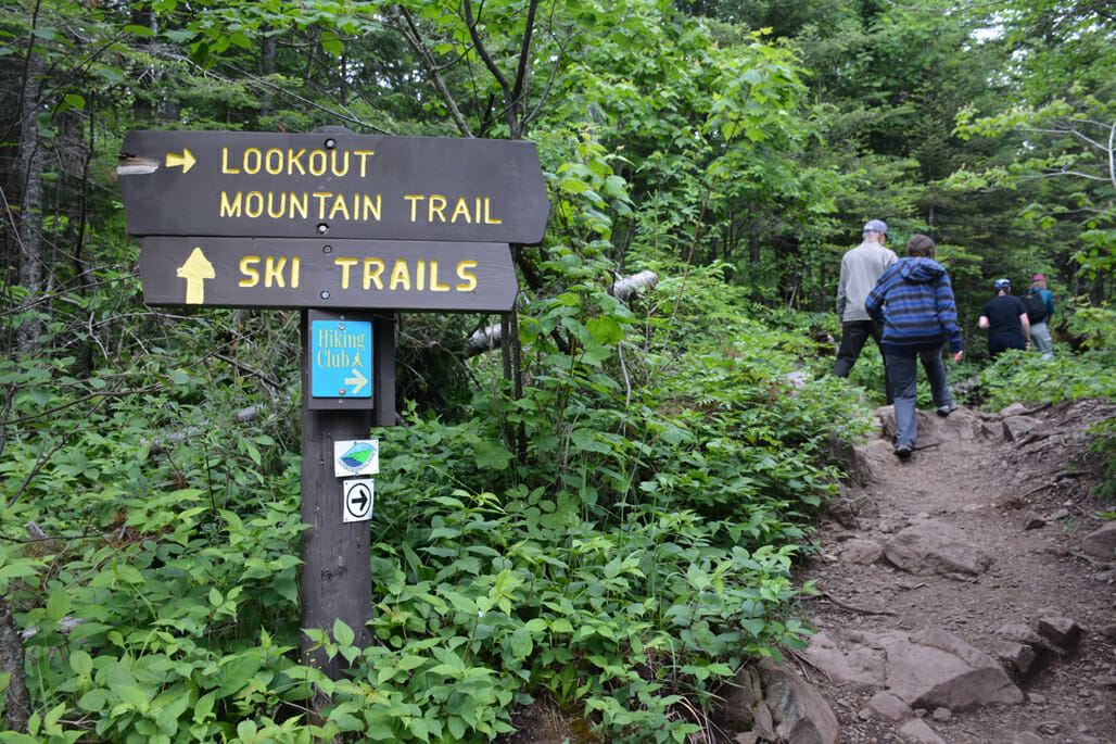
An observation deck within sight of this intersection provided a view of six cascades above and another below, a compelling place for photos.
A bridge crossed the river here, but I wanted to explore upriver a bit more. Trails led in five different directions from the river crossing; I stuck to the Superior Hiking Trail route.
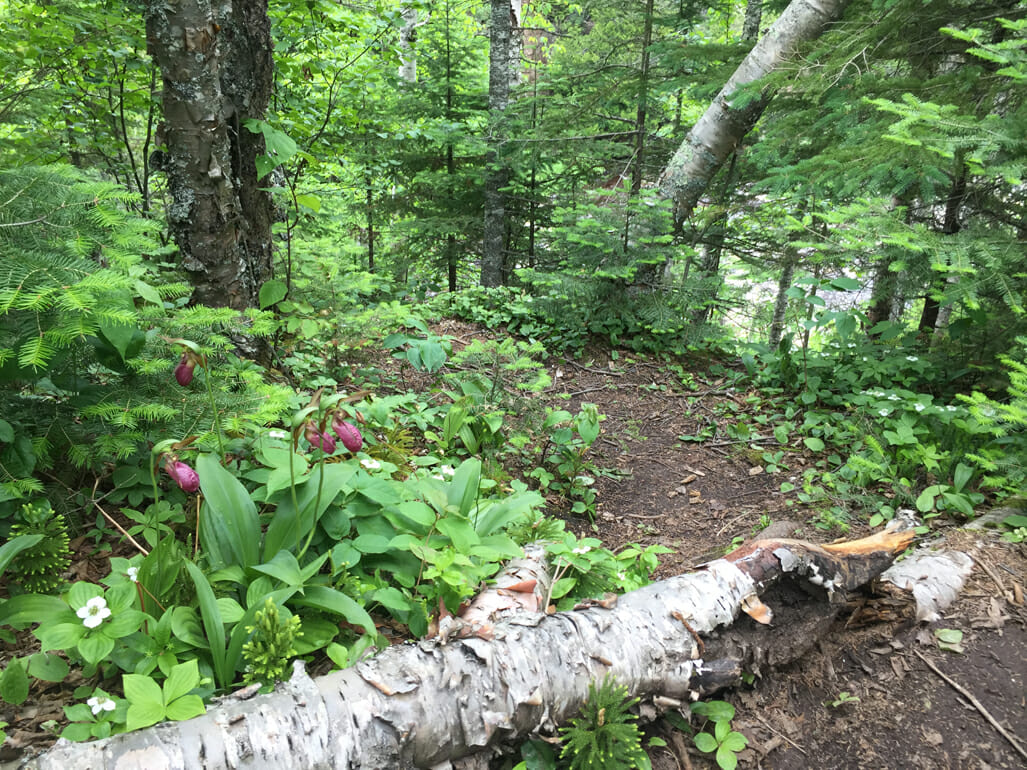
I've always loved the North Woods, having grown up in a little patch of them in the Appalachian Mountains of New Jersey. Biologists call this habitat a boreal hardwood-conifer forest, where birch, fir, and spruce dominate the tree canopy. The fragrance of this landscape, which tends to be thick with mosses upon which wildflowers grow, provides a natural aromatherapy. Add the roar of the cascades in a deep canyon below, and the effect is a calming, almost meditative, walk.
I found plants I remembered from my childhood backyard, like colorful pink lady's-slipper, a ground orchid; carpets of bunchberry, their big white blossoms and distinctive leaves reminding you they're part of the dogwood family, despite growing as a ground cover; and club moss, one of the most ancient plants on earth, looking like tiny evergreens to shade thimble-sized forest dwellers.
After several overlooks provided perspectives on the river, it was time to turn around when the next trail junction took the footpaths off in directions far from my car. Returning to the bridge, I followed the wildest of the cascades downriver on their eastern side, delighted at the difference in perspectives from these rocky cliffs.
I'd never seen a river of waterfalls before, but it's one I'd gladly hike again: not just for the views but the surroundings, and with a picnic lunch and a whole day, not just a morning, to immerse in the grandeur of these woods.
Visit Cascade River State Park
Cascade River State Park is located at 3481 W Hwy 61, Lutsen, Minnesota, between Lutsen and Grand Marais along Lake Superior's North Shore.
While the trailhead I started from [47.707047,-90.524142] at MM 101 on Scenic Highway 61 is free and open to all visitors, there are additional trailheads inside the park gates, as well as car camping, RV, and backcountry campsites. A fee is charged for state park access through the main gates. Nearby Cascade Lodge connects to the trail system and has both a historic lodge and cabins that overlook Lake Superior, plus a restaurant.
Hiking / camping season is considered May 5-Oct 21, with prime weather for playing outdoors being Aug-Oct. June is mosquito and blackfly season, and whenever I stopped, I'd get swarmed. You'll find less insects if you plan a trip from late July onward.
Member discussion