Counting on Ninety Six
While driving the back roads in South Carolina, Sandy asked me if I'd ever been to the Ninety Six National Historic Site, which commemorates a Revolutionary War battle that I didn't recall ever hearing about. I remember names like Nathanael Greene and Cornwallis from long-ago history classes. But their roles in this country's history had long been forgotten by me.
The original settlement of Ninety Six was located at a crossroads between several important roads, including the Charleston Road and the Cherokee Path. It was here in the early 1750s that a trading post was established. The town of Ninety Six continued to grow. No one knows for sure how Ninety Six got its name. One explanation is that the traders thought the intersection was 96 miles South of the Cherokee town of Keowee.
Two battles at Ninety Six would ensure its place in history. The first took place on November 19, 1775, making it the first land battle of the American Revolutionary battle in the South. After six days of fighting, both sides agreed to a truce.
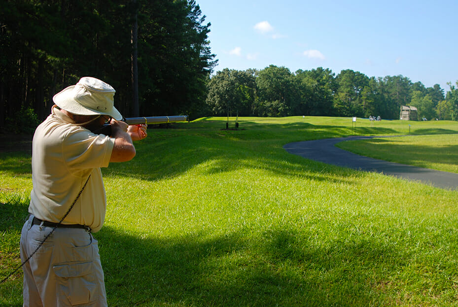
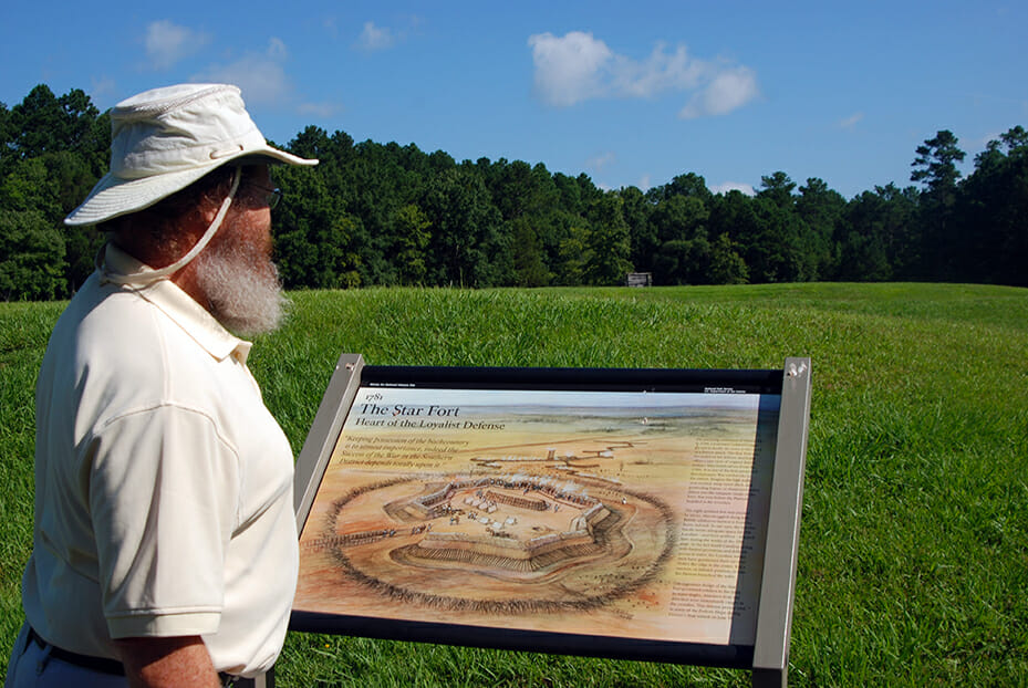
In 1781, the still British Loyalist town of Ninety Six was attacked again by American Patriots. Expecting an attack at some point, the town's military leaders had built an earthen star fort, which kept the Patriots , led by Major General Nathanael Greene, at bay. Greene's army began a siege battle, slowly digging zig-zag trenches closer and closer to the fort's walls while musket and cannon fire zinged overhead.
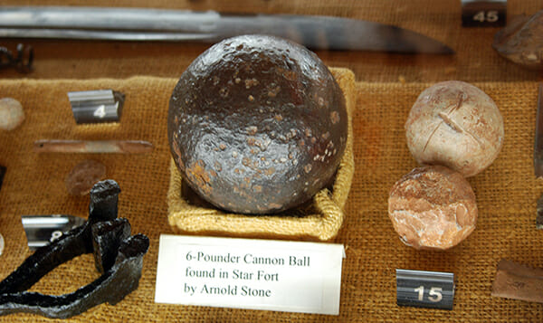
With time running out before British reinforcements arrived, fifty of the Patriots left the trenches, now within forty yards of the fort, and stormed the walls of the fort. Hand to hand combat broke out. The British were ordered to enter the trenches to drive off the Patriots. Both sides suffered heavy losses.
With their reserves tapped, Greene and his army slipped away before dawn. He may have lost the siege, but with the town's stronghold weakened. The Loyalists abandoned the town, and set fire to it as they left, bringing a sad end to the once prospering town of Ninety Six.
Within a few years a new town arose near the site of the old one. It became the town of Cambridge, the county seat and home to an academy. Unfortunately, by the early 1800s, it began to decline. An 1815 flu epidemic took its toll. By the mid 1850s, both Ninety Six and Cambridge were nothing more than memories.
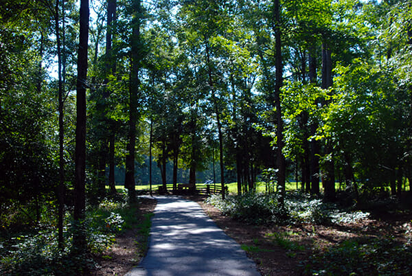
Luckily for us, the site remains virtually untouched. The remains of the earthen star fort are still intact. To show it off, the National Park Service has created a wonderful interpretive trail. You can easily follow the path of Major General Greene's troops as they edged closer and closer to the fort. You'll even learn of a tunnel and plans to plant explosives under the fort.
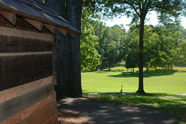
The trail takes you past the site of the old town, the old jail, over the creek and to a replica of the Stockade Fort, Williams Fort of 1775 and later Holmes Fort of 1781, built to provide protection from Indian attacks. The replica has been reconstructed on the foundations of the original buildings.
Walking to the site of the earthen fort and battlefield we came to the site of Island Ford Historic Road, a worn pathway several feet deep. If you look closely, you can see how it runs across the park. In all, there are worn pathways of four historic roads that met at Ninety Six: the Charleston Road, the Island Ford Road, the Whitehall Road, and the Cherokee Path.
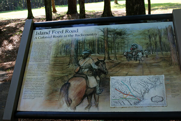
As you see these roads and their depressions from use, think of all the feet, animal hooves, and wagons that went down these roads to wear them ever so deeply. My guess is that few, if any, ever saw the tire of a motorized vehicle.
If your time permits, you can follow these roads and other trails through the park, walking along the same path that the traders and trappers, Native Americans, and settlers once walked, past graveyards and through a beautiful hardwood bottomland forest.
Ninety Six was a pleasure and a surprise. Being a National Historic Site and a bit off the beaten path outside Greenwood, South Carolina, it's below the radar of many of the National Park pilgrims. Our visit was quiet and uncrowded.

Member discussion