Riding the Royal Shenandoah Greenway
When we were researching bike paths in Virginia, Front Royal popped up on our radar. We knew it as an Appalachian Trail community since we'd stayed there during our 2012 AT hike, but we didn't expect it to be a place for cycling.
Who knew?
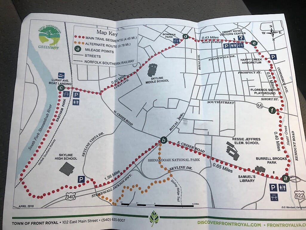
We'd found a rough map online, but weren't having much luck when we asked locals about the trail, until we stopped in the Visitor Center downtown along Main Street. They had a copy of the map we could take with us.
Front Royal is a trail town, but not just because of the AT. Paddling and rafting is big here as well, thanks to the Shenandoah River. Two outfitters offer bike rentals, and Mountain Trail Outfitters downtown has plenty of gear and guidebooks to both help backpackers coming in on the AT and to keep day hikers headed to Shenandoah National Park happy.
As we drove along US 522 towards Mountain Home B&B, our home for the evening, we noticed people walking and biking on a paved path that turned right off of Main Street. It didn't connect to the AT, but we thought it was likely a part of the elusive greenway we were seeking. Day slipped into evening too quickly. We had to save the ride until morning.
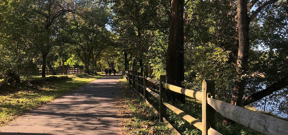
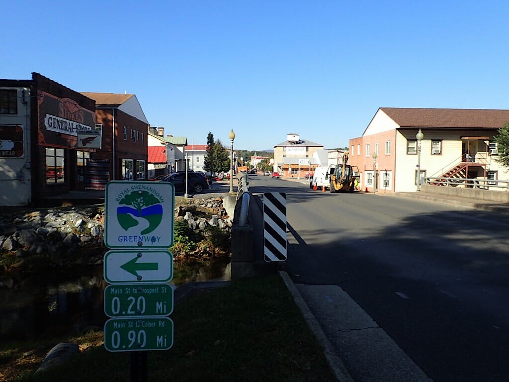
After breakfast, we drove to Eastham Park along the Shenandoah River so I could ride the Greenway. According to the map, it was a little less than a 5-mile loop around town. I started out clockwise, but I was unable to locate any signage as to where the Greenway went along Luray Avenue, and there wasn't a paved path in that direction. So I turned around and followed the paved path along the Shenandoah River.
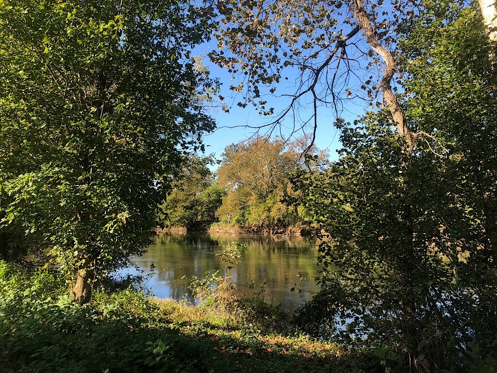
While it offered views of the Shenandoah River, it also passed a playground and a couple of dog parks, each with large fenced areas with signs to separate the larger and smaller dogs. In the center of one of the enclosures, I noticed a red fire hydrant. It left me wondering. Is it real, or just an object for the visiting dogs to take advantage of?
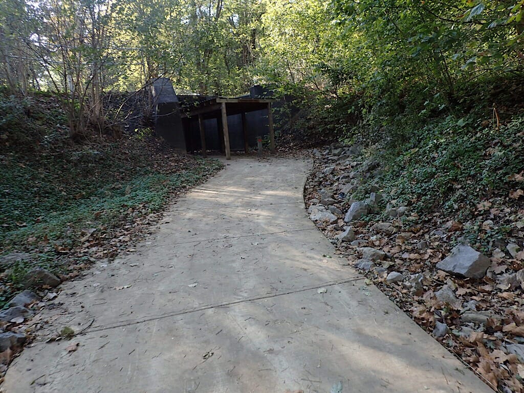
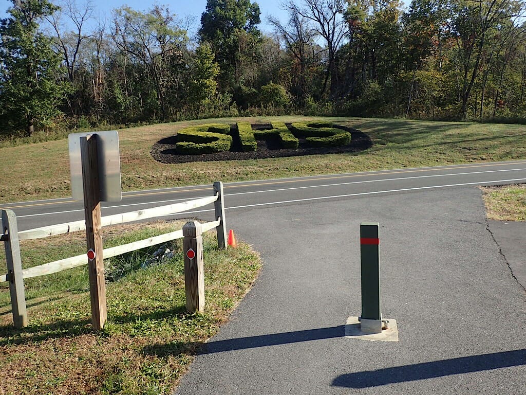
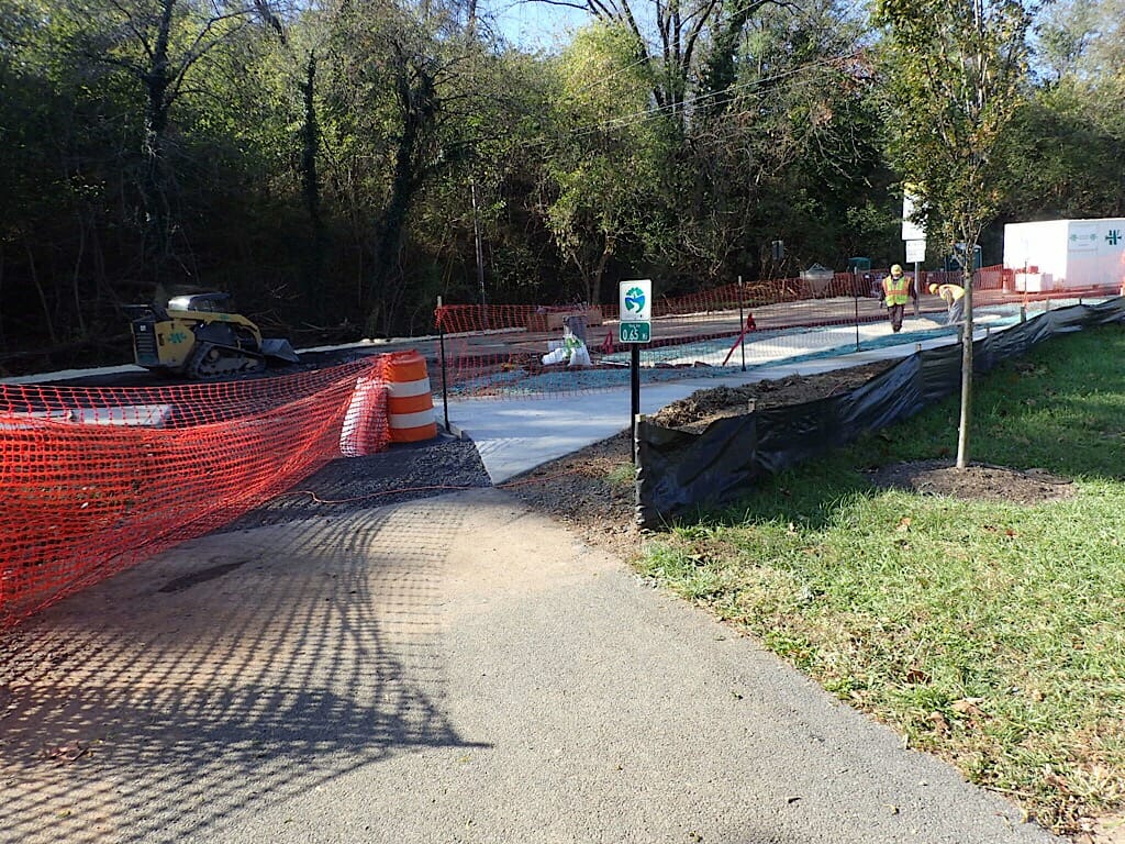
The trail went through a tunnel under an active railroad trestle before it began a climb out of the river valley. It was a long and windy path, leading past several interpretive sites and an outdoor classroom, as well as a fenced-off entrance to a cave. I ended up near the entrance to the local high school.
There was nothing to direct my way except the asphalt path, which came to a traffic light and ended. At the light, no signs told me whether I should turn left or right, or if I was even still on the trail.
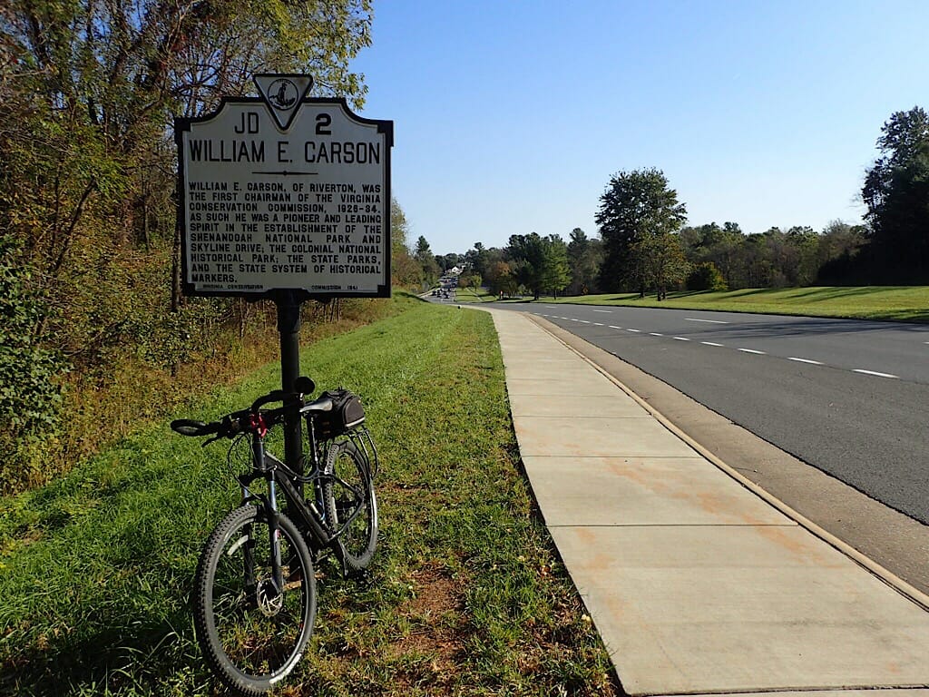
Luckily I had a copy of the map with me. Without it, I would have turned around here and rode back to the park. After crossing Skyline Vista Drive, a two-lane road, I followed a sidewalk along the busier four-lane US 340 up a hill to a historic marker honoring William E. Carson, the man who was the driving force behind establishing Shenandoah National Park and the Virginia State Park system.
I passed the entrance to Skyline Drive, which runs the length of Shenandoah National Park along the ridge. We'd driven it a few years ago to enjoy the fall colors, so we planned to follow a different route south on this trip.
At the next intersection, across from a convenience store, I followed the map directions and crossed the four lanes of US 340 at Criser Road by using the pedestrian crossing lights. Pedaling up another steep hill, I shared the narrow sidewalk with two fellows mowing the grass. Both politely came to a stop to let me ride by. That was very nice.
If you ever happen to be mowing and want to let a pedestrian or cyclist past, please shut off the mower or have the blade face away from the direction of their travels.
Crossing the street to another sidewalk, this time in front of an elementary school, I passed the Samuels Public Library. After crossing another side street, the trail continued along the sidewalk toward Happy Creek. I was able to scoot into Burrell Brooks Park and follow a path through the woods.
As I approached the creek, I could see "Road Closed" signs. Kristen and John at River and Peak Outfitters had warned me that the bridge was closed, but that the trail turned just prior tho the closure, so I'd be able to continue along the loop. They were correct.
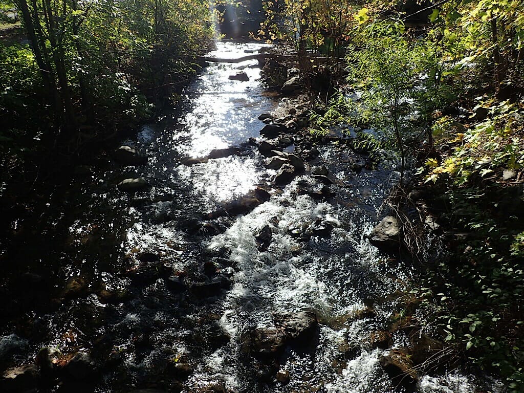
The Royal Shenandoah Greenway jumped on a narrow path where I rode within a couple of feet next to the highway workers. It made a hard left and led me onto an asphalt trail paralleling Happy Creek.
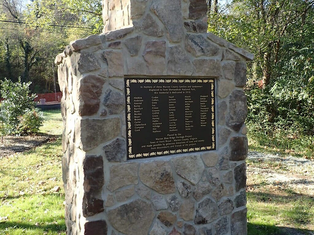
At the corner, I was greeted by a sign and a monument shaped like old fireplace and chimney. It was a monument to the people who lost their farms, homes, and lands in the forming of the Shenandoah National Park.
I recall interpretive information about the loss of these farmsteads at the park, but this is the only monument of its kind that I have ever seen. It was nice to see that it was sponsored by members of the local community.
As the trail continued along Happy Creek, I came out of the natural surroundings along the side of a shopping plaza, and met a very busy road. Misreading the map, I turned left along the busy road on a narrow sidewalk crossing the entrances to the shopping plaza and other businesses.
Thinking that this didn't feel right for a greenway, I backtracked and found where I had missed the pedestrian crossing. Back on the trail, I rode along the creek for a short distance, including across a very narrow bridge.
After crossing Stonewall Drive, I arrived at Main Street. Below the greenway sign, there was an arrow pointing back toward the direction that I had just come from. I checked the map again. Sure enough, they needed an arrow right here to point me down Main Street.
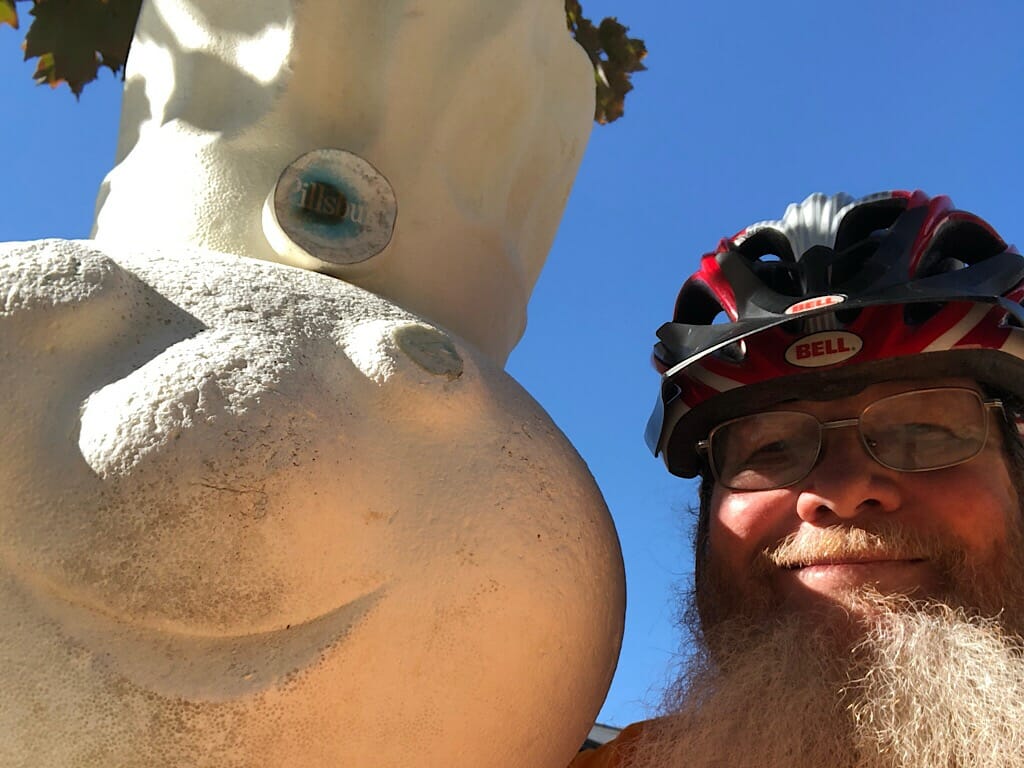
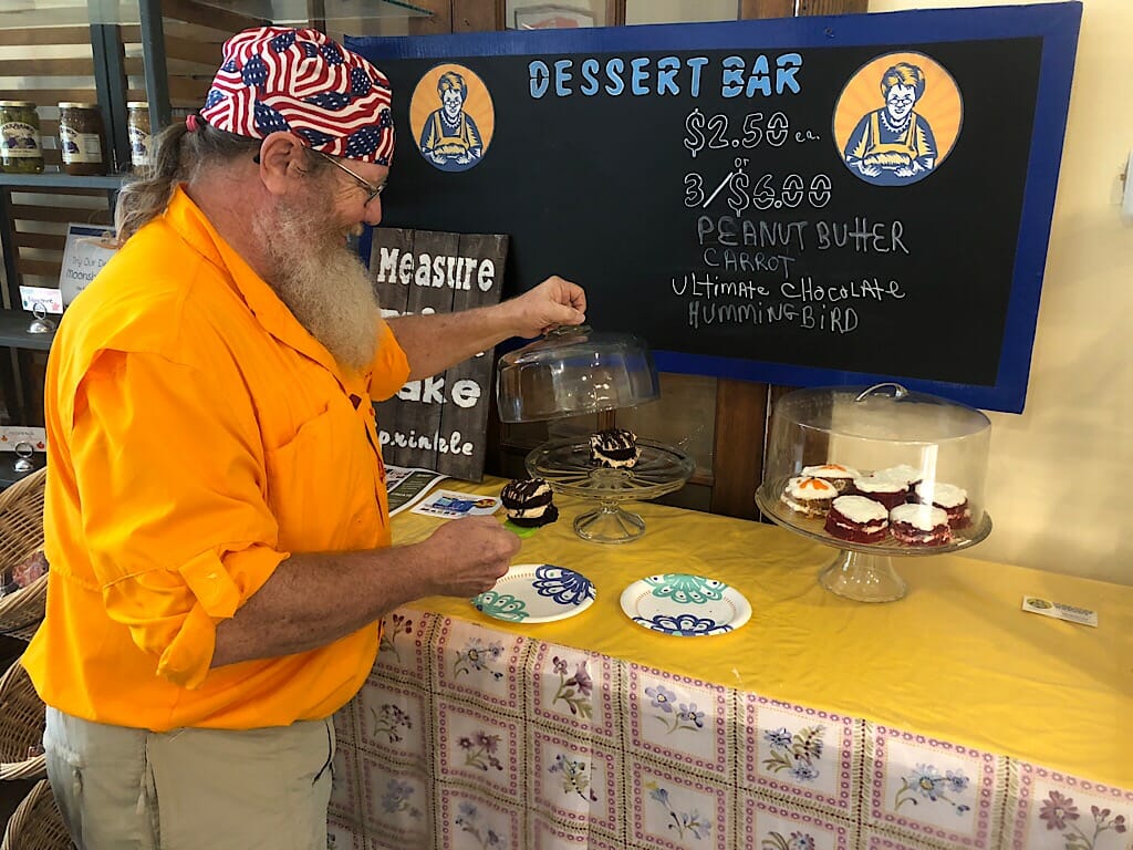
Since I knew that the rest of the ride would be through downtown and on a road or sidewalk back around to Eastham Park, I checked in with Sandy. We decided to meet at the Down Home Comfort Bakery on Main Street, since that was our next stop. After a selfie with a five foot tall Pillsbury Doughboy, I waited for her inside.
No more questions about turning right or left. The only decision l needed to make was about which of the yummy baked items I was going to have to celebrate the completion of my ride-- and my birthday.
Member discussion